How to Deliver Drone Survey Data Clients Can Review Without Special Software
Why standard drone data delivery needs a rethink
Delivering drone survey data used to mean handing over a hard drive full of files or sending a download link for a massive zip archive. The client then had to install proprietary software, request access to a specific viewer, or struggle with files that their everyday computer could not open. That process creates friction. It slows down decision-making and can leave clients frustrated before they even see the results.
Modern drone operations produce rich datasets: orthomosaics, point clouds, thermal maps, and 3D models. Each of these formats may need a different piece of software to view. Asking a client to download and learn multiple tools just to review a survey is not realistic. Fortunately, there is a clearer way to share drone surveys that removes this barrier entirely. The goal is to let clients open, pan, zoom, and measure their data in a standard web browser, just like they would view a photo or a PDF.
Step 1: Process and export to web-friendly formats
The first step happens before any sharing. Raw drone imagery needs to be processed into outputs that a browser can handle. Common formats include GeoPDF, web-optimized JPEG 2000, or tiled image pyramids (like Cloud-Optimized GeoTIFF). For 3D data, consider GLTF or a simple interactive panorama. The key is to avoid raw formats that require GIS or CAD software. Most drone processing software can export to these web-friendly types with a few clicks. Watch out for file size: a single orthomosaic at full resolution can be hundreds of megabytes. That will load slowly over a typical internet connection. Create a lower-resolution "review" version alongside the full-resolution master. This gives clients a fast experience while preserving the original for detailed analysis.

What to check at this stage
- Does the export format open in a standard browser without plugins?
- Is the file size reasonable for your client's typical connection speed?
- Have you kept the coordinate system and projection metadata intact?
Step 2: Upload to a platform with a client portal
Once your files are ready, you need a place to host them that provides controlled access. A client portal is ideal because it gives each client a dedicated space where they can see only their projects. The platform should generate a share link that leads directly to a browser viewer. No downloads, no logins if you prefer. But a simple password or email verification adds security without creating a barrier. During upload, pay attention to file organization. Create a job folder for each project and name files clearly: include the date, site name, and data type (e.g., "2025-03-15_Riverside_Ortho.jpg"). This structure helps clients find what they need without asking you. Most platforms also let you set download permissions. You may want to allow viewing only, or permit the client to download the full-resolution files. Decide this per client. Some may need to pass the data to an engineer; others only want to check progress.
What to watch for
- Does the portal support the file types you uploaded?
- Can you set expiration dates on share links if needed?
- Does the platform show access tracking, so you know when a client viewed the data?
Step 3: Add context and guidance
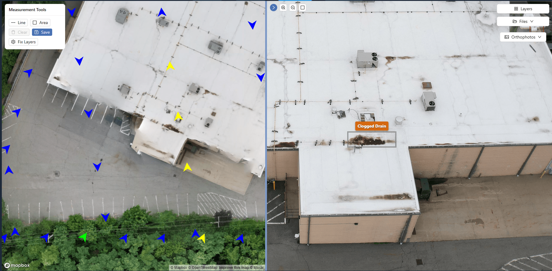
A raw orthomosaic is just a picture without context. Add a simple annotation layer: mark the property boundaries, highlight areas of interest, or include a legend explaining what each color on a thermal map means. Some platforms let you overlay KML or GeoJSON files. If not, a short PDF note beside the data works well. You can also include a brief text description in the client portal: what the survey covers, the date it was flown, and any key findings. This turns a file dump into a deliverable. Clients appreciate knowing what they are looking at and why it matters. Avoid jargon. Instead of "GSD 2.5 cm," say "the detail is sharp enough to see individual manhole covers."
Step 4: Set appropriate watermarks and permissions
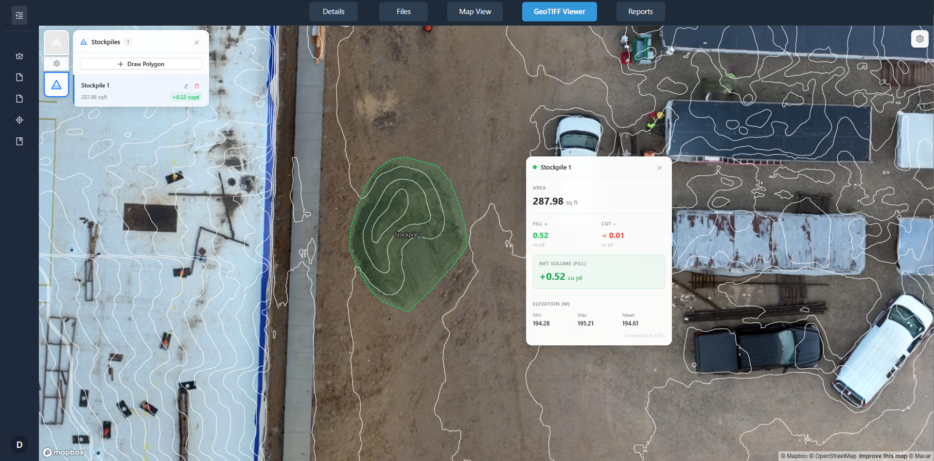
When you share data through a browser viewer, you retain control. A watermark overlaid on the screen, showing the client's name or the project number, discourages unauthorized screenshots. It also reminds viewers that the data is not final if you are still processing. You can remove the watermark for the final delivery. Download permissions matter too. If the client only needs to review, disable download. If they need the files for their own analysis, enable it for the job folder only. This prevents accidental sharing of the wrong dataset. Access tracking complements this: you can see who viewed what and when. That is useful for billing, project management, and proving delivery if a dispute arises.
Step 5: Send the link and brief the client
With everything set up, send the client a short email with the share link and a one- or two-sentence explanation of how to use the browser viewer. For example: "Click the link below to open the survey. Use your mouse wheel to zoom, click and drag to pan. Measurements are available by clicking the ruler icon." Keep it simple. Most clients will figure it out quickly, but a small nudge prevents confusion. If the platform has a help page or a quick video, include that too. One common pitfall: the client receives the link but does not know it is safe to click. Assure them it is a direct link to a secure viewer, not a download. This eliminates hesitation.
Step 6: Follow up with a short review session
After the client has had time to look, offer a brief call or a shared screen session to walk through the data. This is not about selling more work; it is about making sure they understand what they see. Often a client will discover a question only after they start exploring. A five-minute check-in can prevent a long email chain later. It also builds trust. When clients see that you deliver data in a clearer way to share drone surveys, they are more likely to come back for the next project.
Putting it all together
The shift from file-based delivery to browser-based review is not complicated, but it requires a deliberate workflow. Process your data into web-friendly formats. Use a platform that provides a client portal with share links, download permissions, and access tracking. Organize files in job folders. Add context so the data tells a story. Use watermarks to protect your work. Then send a simple link and follow up. Each step removes a barrier for the client. The result is a professional, hassle-free experience that lets the data speak for itself. No special software, no training, no frustration. Just a link, a browser, and the survey.